Connects: Valdez to Fairbanks, AK
Route#: Alaska 4
Length: 366 miles
Road Surface: Paved
Season: Open all year
Highest Pass: Isabel Pass, elev. 3,280 feet
Maps (2 detailed pdf files available):
Valdez, Ak to Delta Junction, AK
Delta Junction, AK to Fairbanks, AK
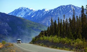
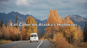
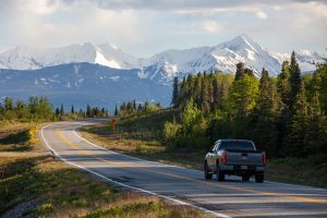
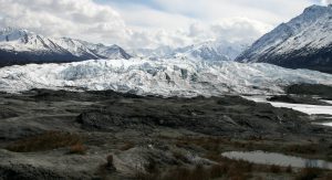
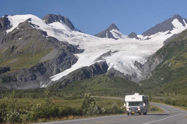
The Richardson Highway is a very scenic route, offering magnificent views of the Chugach Mountains and Alaska Range, and some of the best glacier viewing in Alaska. The Richardson is a wide paved highway in fair to good condition, with some sections of frost heaves and patched pavement.
The Richardson Highway junctions with the Edgerton Highway; the Glenn Highway; the Tok Cut-Off; the Denali Highway; the Alaska Highway; the Parks Highway; and the Steese Expressway/Steese Highway.
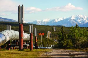
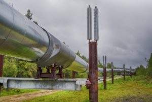
This route offers good views of the trans-Alaska pipeline. The trans-Alaska pipeline carries oil 800 miles from Prudhoe Bay on the Arctic Ocean to the pipeline terminus at Port Valdez.
The Richardson Highway was Alaska’s first road, known to gold seekers in 1898 as the Valdez to Eagle Trail. Gold stampeders started up the trail again in 1902, this time headed for Fairbanks, site of a big gold strike. The Valdez to Fairbanks trail became an important route to the Interior, and in 1910 the trail was upgraded to a wagon road under the direction of Gen. Wilds P. Richardson, first president of the Alaska Road Commission. The ARC updated the road to automobile standards in the 1920s; it was hard-surfaced in 1957.
Communities


The MILEPOST® Quick Reference Log
Miles from New Valdez (NV) and Fairbanks (F) shown.
NV 0 F 366 Downtown VALDEZ (pop. 4,011); all services.
NV 3.4 F 362.6 Acres Kwik Trip gas station, deli, market, laundromat. Turnoff for Valdez airport and Valdez Glacier campground.
NV 4 F 362 Milepost 0 of the Richardson Highway; Old Valdez Townsite memorial 0.4 mile south on Alaska Ave.
Miles from Old Valdez (V) and Fairbanks (F) are shown. Physical mileposts northbound reflect distance from Old Valdez.
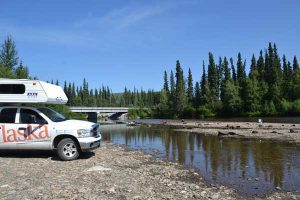
V 2.8 F 359.2 Junction with Dayville Road. This paved side road is open to the public to Mile 5.4, and offers fishing, scenic views and camping.
V 24.1 F 337.9 Blueberry Lake State Recreation Site; camping.
V 26.1 F 335.9 Thompson Pass, elev. 2,678 feet.
V 28.9 F 333.1 Worthington Glacier State Recreation Site: day-use.
V 79 F 283 Tonsina River Lodge, Russian restaurant, lodging, RV park, bar.
V 79.4 F 282.6 Squirrel Creek State Recreation Site, camping.
V 82.2 F 279.8 Pippin Lake Bed and Breakfast.
V 82.5 F 279.5 Junction with the Edgerton Highway to Chitina and McCarthy Road; Kenny Lake Mercantile & RV Park, phone 907-822-3313 (gas/diesel, groceries, RV park, hotel, diner) at Mile 7.2 Edgerton Highway.
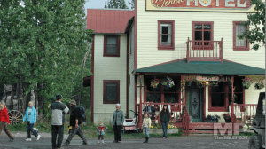
V 100.2 F 261.8 South junction with Old Richardson Highway loop to historic COPPER CENTER (pop. 312); George I. Ashby Memorial Museum and Trail of ’98 Museum Annex. The historic Copper Center Lodge here was destroyed by fire in May 2012 and was replaced by Old Town Copper Center Inn & Restaurant with gas, grocery and liquor store.
V 101.6 F 260.4 Turnoff uphill on Brenwick-Craig Road to west for Copper River Princess Wilderness Lodge; restaurant, lodging, great views.
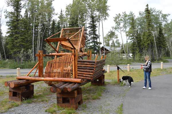
V 106.8 F 255.2 Wrangell-St. Elias National Park and Preserve Visitor Center has indoor geographic and natural history displays. The Ahtna Cultural Center located in the visitor center complex has a fish wheel on display (see photo above) and indoor Native history and cultural displays.
V 111 F 251 Tazlina River Trading Post phone 907-822-3277; groceries, gas, fishing licenses, groceries.
V 115 F 247 Junction with Glenn Highway. GLENNALLEN (pop. 454); all services. The Hub of Alaska (open 24-hours year-round; groceries, gas/diesel) and Copper Valley Visitor Information.
V 118 F 244 Dry Creek State Recreation Site campground.
V 128.5 F 233.5 Junction with Tok Cutoff at Gakona Junction.
V 129.5 F 232.5 Ahtna Inc. Sailors Campground camping and Gulkana River access.
V 147.5 F 214.5 Sourdough Creek BLM Campground.
V 147.7 F 214.3 Historic Sourdough Roadhouse; current status unknown.
V 170 F 192 Meier’s Lake Roadhouse has gas, diesel, dining and lodging; phone 907-822-3151 or email.
V 175 F 187 Paxson Lake BLM Campground.
V 185.5 F 176.5 PAXSON (pop. 15) at junction with the Denali Highway. Paxson Lodge closed in 2013.
V 185.6 F 176.4 Denali Highway Cabins and Paxson Alpine Tours; lodging, electric bike rentals, kayak rentals, hiking trails. Located at Mile 0.2 on the Denali Highway.
V 195 F 167 Summit Lake, elev. 3,210 feet.
V 197.7 F 164.3 Isabel Pass, elev. 3,280 feet.
V 200.4 F 161.6 Fielding Lake State Recreation Area; camping.
V 227.4 F 134.6 Historic Black Rapids Roadhouse adjacent modern Lodge at Black Rapids.
V 238 F 124 Donnelly Creek State Recreation Site, camping.
V 243.5 F 118.5 Pipeline Viewpoint (pictured below).

V 261.1 F 100.9 FORT GREELY (restricted area) main gate to east.
V 265.3 F 96.7 Delta Petro-Wash; 24-hour gas station, deli, convenience store, dump station.
V 265.6 F 96.4 The Calico Cow quilting shop.
V 265.7 F 96.3 Iconic dining spot in Delta Junction is the Buffalo Center Drive-in; phone 907-895-4055. The drive-in is adjacent Sullivan Roadhouse Museum.
V 265.8 F 96.2 Delta Junction Chamber of Commerce Visitor Information Center to the west, phone 907-895-5068.

V 266 F 96 Junction with Alaska Highway at DELTA JUNCTION (pop. 984); food, gas, lodging. Attractions include the End of the Alaska Highway monument (pictured above) and Sullivan Roadhouse Museum.
V 267 F 95 Delta State Recreation Site campground.
V 268.3 F 93.7 Turnoff for Clearwater State Recreation Site (10.5 miles east) and Clearwater Lodge (restaurant, bar, cabins, RV park), located just east of the recreation site
V 272.1 F 89.9 Big Delta (pop. 484), an unincorporated community.
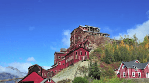
V 275 F 87 Gas station with diesel to west. Turnoff to east for Big Delta State Historical Park. This 10-acre park on the Tanana River features the historic Rika’s Roadhouse (pictured below), log cabin museums, historic out buildings, walking trails, camping/RV sites and The Roadhouse Cafe and Gift Shoppe at Rika’s (open mid-May to mid-September; phone 623/696-5919).

V 275.5 F 86.5 Tanana River/Pipeline Crossing.
V 277.7 F 84.3 Quartz Lake State Recreation Area; camping.
V 293.5 F 69.5 Tenderfoot Pottery.
V 305.2 F 56.8 Birch Lake State Recreation Site; camping.
V 306 F 56 Rest area on shore of Birch Lake.
V 315 F 47 camping/RV sites at Lazy Moose RV Park and Gift Shop.
V 321.5 F 40.5 Harding Lake State Recreation Area; camping.
V 322.2 F 39.8 SALCHA (pop. 1,048): food, lodging.
V 323.1 F 38.9 Salcha River State Recreation Site; camping.
V 328.3 F 33.7 Gas and convenience store.
V 332.5 F 29.5 The Knotty Shop; gifts, wildlife display, ice cream, burl art work. Open all year.
V 341.3 F 20.7 EIELSON AIR FORCE BASE (pop. 2,867).
V 343.6 F 18.4 Bathing Beauty Pond, picnic area and stocked with rainbow.
V 346.6 F 15.4 Chena Lakes Recreation Area; camping, fishing, swimming and access to Moose Creek Dam Bikeway.
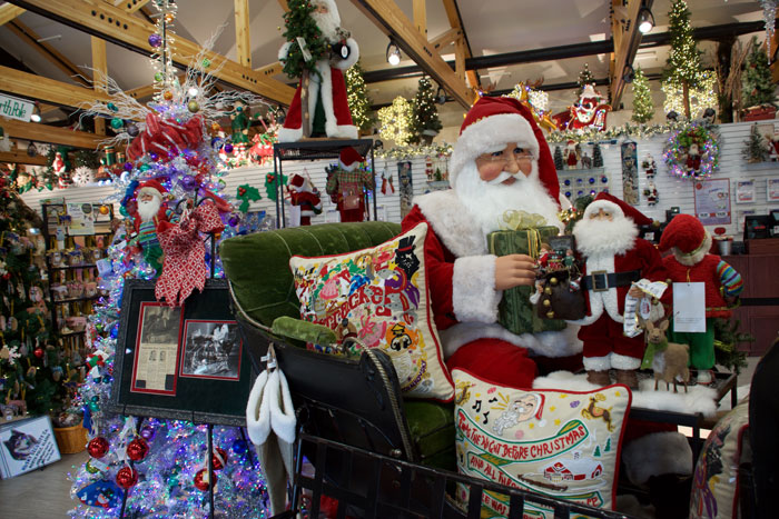
V 349 F 13 NORTH POLE (pop. 2,138); all services. Visitor information. Attractions here are the Santa Claus House, the Antler Academy of Flying & Reindeer Games, KJNP radio/TV sod-roofed complex. Lodging at Hotel North Pole.
V 356.6 F 5.4 Camping at the Fairbanks / Chena River KOA on Badger Road.
V 362 F 0 FAIRBANKS.