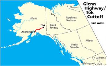
Connects: Tok to Anchorage, AK
Route#: Alaska Route 1
Length: 328 miles
Road Surface: Paved
Season: Open all year
Highest Pass: Eureka Summit, elev. 3,322 feet
Maps (3 detailed pdf files available):
Tok Cutoff (Mileposts GJ-125 to GJ 0) to Milepost A 160
Milepost A 160 to Anchorage, AK
Mat-Su Valley Vicinity
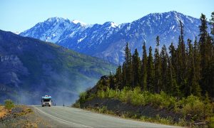
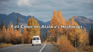
The Glenn Highway/Tok Cutoff is the principal access route from the Alaska Highway west to Anchorage, a distance of 328 miles. This paved all-weather route includes the 125-mile Tok Cutoff, between Tok and the Richardson Highway junction; a 14-mile link via the Richardson Highway; and the 189-mile Glenn Highway, between the Richardson Highway and Anchorage. The 139-mile stretch of the Glenn Highway between Anchorage and Eureka Summit is a National Scenic Byway.
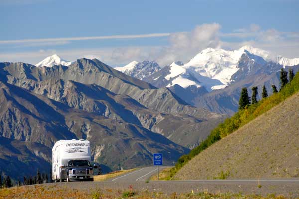
Road conditions are generally fair to good along the Tok Cutoff and Glenn Highway, depending on scheduled road reconstruction projects that range from fixing frost-heaved sections of pavement —by first taking it back to gravel— to realigning and widening portions of the highway.
Communities


The MILEPOST® Quick Reference Log
Miles from Tok (T) and Anchorage (A) shown. Physical mileposts on the Tok Cutoff show distance from Gakona Junction.
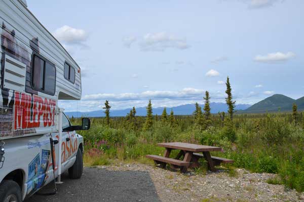
T 0 A 328 TOK at junction with the Alaska Highway; all services. Head west on the Tok Cutoff towards Glennallen.
T 2.2 A 325.8 Sourdough Campground, at Milepost GJ 122.8, home of the “World Famous Pancake Toss”; full hookups, laundry, RV/car wash.
T 15.8 A 312.2 Eagle Trail State Recreation Site: camping.
T 60.8 A 267.2 Porcupine Creek State Recreation Site: camping.
T 64 Midway Service at Milepost GJ 61; grocery, cabins, tent camping.
T 65.2 A 262.8 Junction with Nabesna Road; access to Slana Ranger Station at Mile 0.2 has information on Wrangell-St. Elias National Park and road conditions; Hart D Ranch at Mile 0.5 has camping and lodging. Side trip to Dead Dog Hill Wayside (pictured below) at Mile 17.8 or Rock Lake Wayside at Mile 21.8 recommended. Nabesna Road deadends at Devils Mountain Lodge at Mile 42. Unmaintained road continues to Nabesna Gold Mine.
T 72 A 256 Grizzly Lake Campground at Milepost GJ 53; cabins, camping, phone 907-822-5214. View of Wrangell Mountains from lakeside sites.
T 90.4 A 237.6 Posty’s Sinona Creek Trading Post at Milepost GJ 34.6, phone 907-822-5454 or email; gas, diesel, propane, groceries, snacks, Native arts crafts and gifts. Open daily year-round.
T 92.3 A 235.7 Red Eagle Lodge at Milepost GJ 32.7; lodging, camping, breakfast, bathhouse at historic roadhouse site.
T 123 A 205 Historic Gakona Lodge & Trading Post (est. 1929); lodging, restaurant (dinner only).
T 125 A 203 Gakona Junction. Junction of Tok Cutoff with Richardson Highway north to Delta Junction and south to Valdez. Anchorage-bound travelers turn south; Tok-bound travelers turn east.
Physical mileposts on the Richardson Highway show distance from Valdez.
T 136 A 192 Dry Creek State Recreation Site; camping.
T 139 A 189 Junction of the Richardson Highway with the Glenn Highway; Anchorage-bound travelers turn west on the Glenn Highway. The Hub of Alaska, 24-hour gas, diesel, propane, ATM, convenience store, phone 907-822-3555. Open year-round.
Physical mileposts on the Glenn Highway show distance from Anchorage.
T 139.3 Northern Nights Campground RV Park & Cabins; RV and tent sites, shower/laundry, cabins, open May-Sept.
T 140.9 A 187.1 Copper Valley IGA; very nice supermarket with espresso, deli and bakery; phone 907-822-3334 or email.
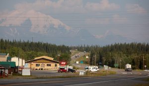
T 141 A 187 GLENNALLEN (pop. 465); all services. Lodging and dining at The Caribou Hotel. Glennallen is headquarters for Ahtna Incorporated; Ahtna Land Use Permits may be purchased here, or go online.
T 141.3 A 186.7 Cross Road Medical Center; pharmacy, clinic, EMS, 24-hour emergency room.
T 155 A 173 Turnoff for Ranch House RV Resort and Historic Roadhouse with RV hookups, cabins, tent sites, restaurant and tavern. Also turnoff for Tolsona Wilderness Campground and RV Park with 80 creekside campsites, hookups, tent sites, showers, laundromat, dump station, mini-store.
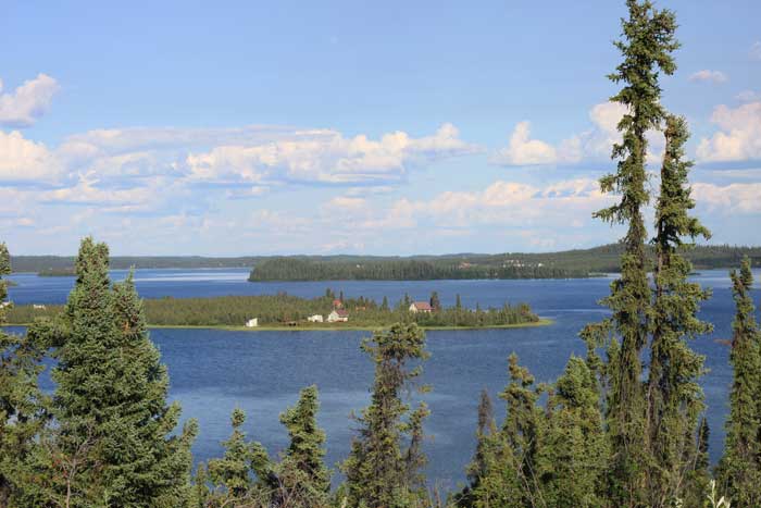
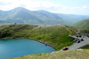
T 168.2 A 159.8 Junction with 19.3-mile-long Lake Louise Road to Lake Louise (pictured above); fishing, lakeside lodges, camping at Lake Louise State Recreation Area. Food and lodging at The Point Lodge and Lake Louise Lodge.
T 198.5 A 129.5 Eureka Summit (elev. 3,322 feet), highest point on the Glenn Highway.
T 199.7 A 128.3 Eureka Lodge; gas, food
T 213.1 A 114.9 Majestic Valley Wilderness Lodge, lodging with gourmet meals, wildlife viewing.
T 214.5 A 113.5 Sheep Mountain Lodge; restaurant, guest cabins, RV hookups, trail hiking.
T 218.3 A 109.7 Grand View Cafe & RV Campground; meals, desserts, espresso, RV hookups, tent sites.
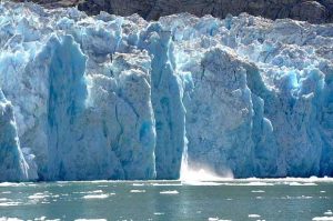
T 225.9 A 102.1 Matanuska Glacier Access at Glacier Park.
T 227 A 101 Matanuska Glacier State Recreation Site; camping, viewpoint, picnicking.

T 231.6 A 96.4 Trailhead Road to staging area for Matanuska River trips with Nova River Runners.
T 233.3 A 94.7 Access north via Victory Road to lodging at Bear Den Cabins and Homestead Guest Cabins.
T 242.6 A 85.4 Long Lake State Recreation Site; fishing, day-use.
T 251.2 A 76.8 CHICKALOON (pop. 245).
T 251.6 A 76.4 King Mountain State Recreation Site; camping.
T 266.4 A 61.6 Alpine Historical Park, a museum featuring the concrete foundation of the Sutton Coal Washery (1920-22).
T 267 A 61 SUTTON-ALPINE (area pop. 967), general store, cafe and fire station.
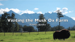
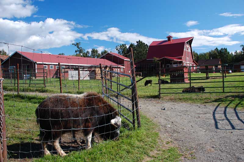
T 277.9 A 50.1 Turnoff on Archie Road to north for Musk-Ox Farm (pictured below); tours, gift shop. (Watch slide show)
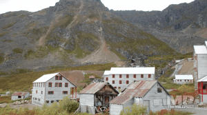
T 278.5 A 49.5 Junction with Palmer-Fishhook Road/Hatcher Pass Road to Independence Mine State Historical Park (pictured below) 17.2 miles from this junction, and continues on to junction with the Parks Highway 49.1 miles from here. Services along this road at Turner’s Corner at Mile 6.5 (gas, diesel, grocery and liquor store, soft serve ice cream); Hatcher Pass B&B at Mile 6.6; and Hatcher Pass Lodge at Mile 17.2 ( cabins and restaurant).

T 286 A 42 Junction with Old Glenn Highway which loops south 18.4 miles to rejoin the Glenn Highway at Milepost A 29.6. Access via Old Glenn south from Palmer to: Matanuska River Park (1 mile) RV/tent camping, email; Mountain View RV Park (2.8 miles); and Knik Glacier Tours (9.8 miles to Knik River Road turnoff, then 8.4 miles up that road) with daily tours to Knik Glacier in summer.
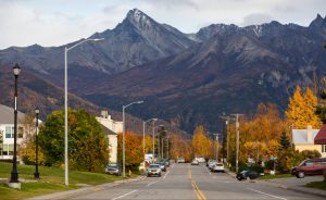
T 286 A 42 PALMER (pop. 6,296); dining, shopping, lodging. Visitor information. Attractions include Colony House Museum, Matanuska Valley Agricultural Showcase Gardens, and the annual Alaska State Fair.
T 287.8 A 40.2 Main entrance to Alaska State Fairgrounds. Alaska State Fair is held the end of August through the first week in September.
T 287.3 A 40.7 Noisy Goose Cafe, serving breakfast all day. A unique Alaskan family-style restaurant; phone 907-746-4600.
T 292 A 36 Fox Run Lodge & Campground; RV and tent camping, hotel room, laundry, showers, restaurant, canoe rentals.
T 292.9 A 35.1 Glenn–Parks Interchange Junction with exit to Parks Highway (Alaska Route 3) north to Denali National Park and Fairbanks.
T 297.4 A 30.6 Knik River Access exit to Reflections Lake; loop trail, interpretive panels, wildlife watching.
T 298.4 A 29.6 Junction with Old Glenn Highway, which loops north 18.4 miles to Palmer. Access from here to Knik Glacier Tours (8.6 miles to Knik River Road turnoff, then another 8.4); Mountain View RV Park (15.6 miles); and Matanuska River Park (1 mile).
T 301.5 A 26.1 Exit for Eklutna Lake Road and Eklutha Historical Park. Eklutha Lake Road leads to Eklutha Lake Recreation Area (10 miles); camping. Rochelle’s Ice Cream Stop/Store/Cabins/Gold Panning is at Mile 8 on this side road. Westbound access to Thunderbird Falls hiking trail (0.7 mile).
T 302.8 A 25.2 Eastbound exit only to Thunderbird Falls hiking trail.
T 306.1 A 21.9 Exit to PETERS CREEK: food, gas, grocery and Bobby’s Peter’s Creek RV Park, phone 907- 688-2487.
T 306.9 A 20.9 Exit to CHUGIAK (pop. 5,484): convenience store, gas, diesel, showers and laundry at Vitus Energy, (907) 309-0114.
T 310.8 A 17.2 St. John Orthodox Cathedral, a unique geodesic-dome cathedral. Visitors welcome at services.
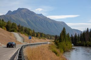
T 314.6 A 13.4 Exit to EAGLE RIVER (pop. 24,000); all services. Eagle River Road (pictured below) to Eagle River Nature Center, a wonderful spot with nature trails and year-round nature programs.

T 316.4 A 11.6 Exit for Eagle River Campground, Chugach State Park: camping. Also access to South Fork Valley trailhead.
T 320.5 A 7.5 Richardson Gate to Joint Base Elmendorf-Richardson (JBER).
T 323.8 A 4.2 Muldoon Road exit north to Alaska Native Heritage Center and Tikahtnu Commons Shopping Center; exit south for food, gas, lodging and municipal campground (Centennial Park).
T 325.3 A 2.7 Boniface Gate to Joint Base Elmendorf-Richardson (JBER).
T 326.8 A 1.2 Turnoff to north on Mountain View Drive and take first or second right for Glenn Square Shopping Center.
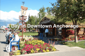
T 328 A 0 Downtown ANCHORAGE.