Connects: Anchorage to Fairbanks, AK
Routes#: Alaska 1 and 3
Length: 362 miles
Road Surface: Paved
Season: Open all year
Highest Pass: Broad Pass, elev. 2,400 feet
Maps (3 detailed pdf files available):
Anchorage, AK to Milepost A 169
Milepost A 169 to Fairbanks, AK
Mat-Su Valley Vicinity
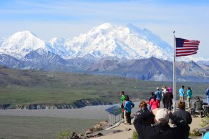
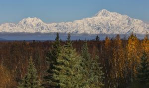
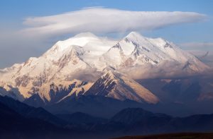
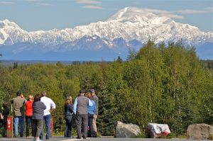
The Parks Highway—formally the George Parks Highway—links Anchorage and Fairbanks and provides the most direct highway access to Denali National Park and Preserve from either city. Denali, formerly Mount McKinley, at elev. 20,310 feet, is visible from the highway (weather permitting). The entrance to Denali National Park is located at Milepost A 237.4 on the Parks Highway, 125 miles south of Fairbanks.
The Parks Highway shares a common alignment with the Glenn Highway (Alaska Route 1) between Anchorage and Wasilla, where it continues north as Alaska Route 3 to Fairbanks. The Parks Highway junctions with the Denali Highway (Alaska Route 8) at Cantwell, Milepost A 210.
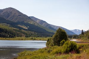
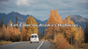
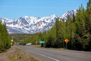
The Parks Highway was called the Anchorage–Fairbanks Highway after its completion in 1971, then renamed the George Parks Highway in July 1975 in honor of George A. Parks, the territorial governor from 1925 to 1933. The entire route runs 362 miles through some of the grandest scenery that Alaska has to offer, crossing the Alaska Range at Broad Pass.
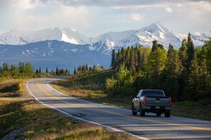
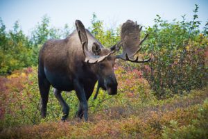
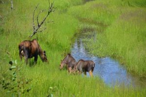
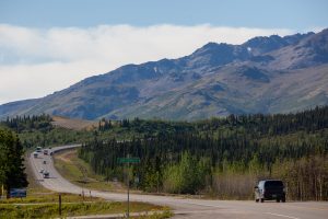
The Parks Highway is a good 2-lane paved road, with passing lanes on improved sections. Several sections of moderate S-curves and heavy foliage reduce sight distance: Pass with care. Drive with headlights on at all times. Watch for moose. Towing: Parks Highway Towing (907) 832-5583.
Main Attractions

Communities


The MILEPOST® Quick Reference Log
Miles from Anchorage (A) and Fairbanks (F) shown.
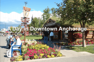
A 0 F 362 ANCHORAGE (pop. 297,483); all services. Follow the Glenn Highway (Alaska Route 1) from Anchorage 35 miles northeast to junction with the Parks Highway.
A 34 F 328 Northbound exit to east for Glenn Highway to Palmer and Glennallen.
A 35 F 327 Glenn-Parks Interchange.The Parks Highway continues north.
A 36.1 F 325.9 Mat Su Regional Medical Center to east off of Trunk Road.
A 37.8 F 324.2 Access to Big Bear RV Park; big rig friendly, rental cabins, laundry, propane.
A 41.1 F 320.9 Junction with Palmer-Wasilla Highway; access east to RV-friendly Essential One station with gas, diesel, bio-diesel, propane, ice and food.
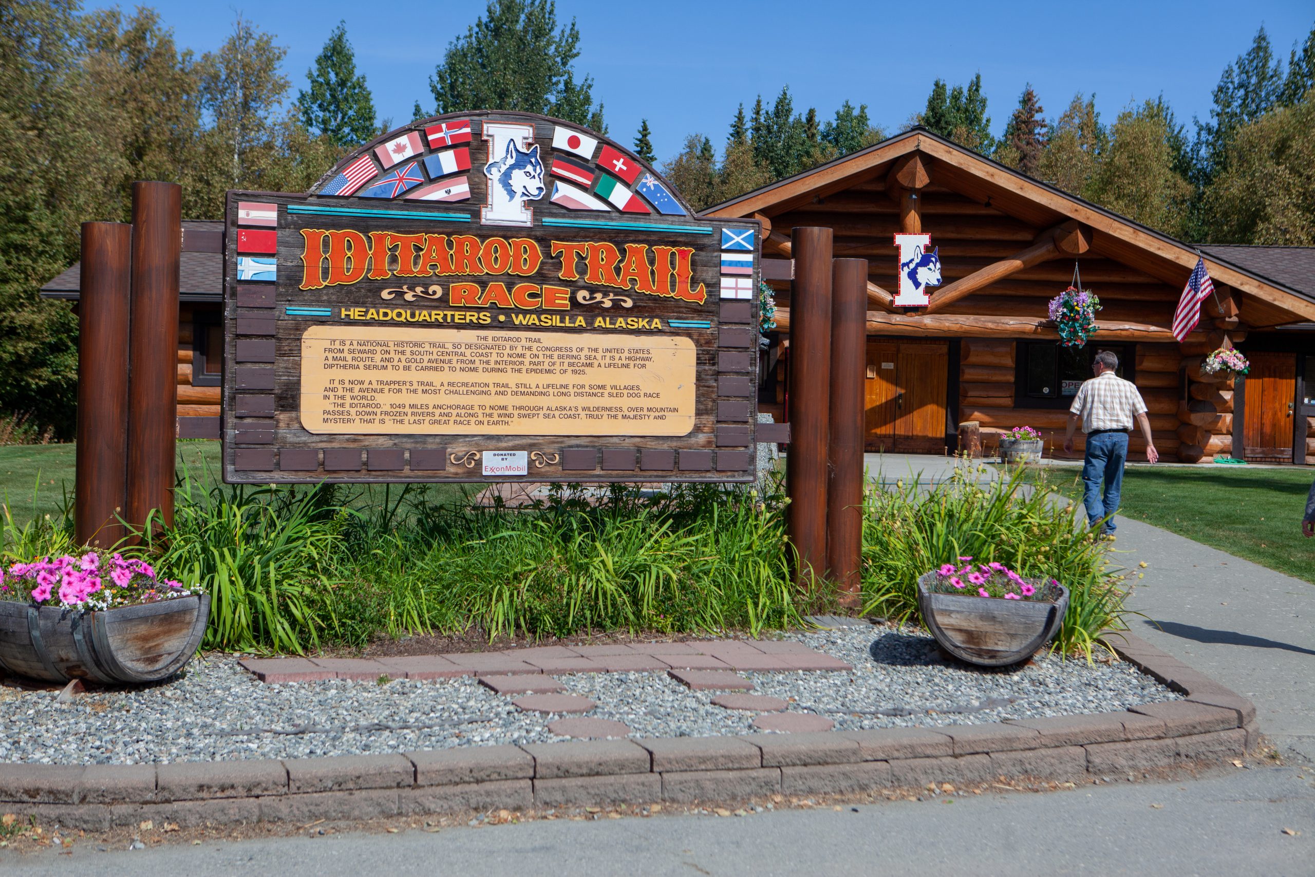
A 42.2 F 319.8 Junction with Knik-Goose Bay Road and access southwest to Iditarod Trail Sled Dog Race Headquarters (pictured at left) at Mile 2.1, with museum, gift shop, summer dog cart rides, open year-round; Knik Knack Mud Shack gift shop at Mile 8.4; Knik Museum at Mile 13.9; and turnoff at Mile 19.7 for access to Little Susitna River Public-use Facility at Mile 13.1 Point Mackenzie Road.
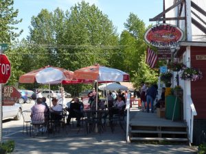
A 42.2 F 319.8 WASILLA (pop. 9,200); all services. Lodging at Best Western Lake Lucille Inn and The Roadside Inn; camping at Lake Lucille Park and Big Bear RV. Visitor information and attractions: Wasilla Museum & Visitor Center and Sylvia’s Quilt Depot. Farmer’s Market Wednesdays in summer.
A 43 F 319.2 Gas/diesel station.
A 43.5 F 318.5 Best Western Lake Lucille Inn.
A 47 F 315 Museum of Alaska Transportation and Industry is open daily Mother’s Day through Labor Day; pioneer farm machinery, trains, boats, lanes, snow machines, mining and military equipment.
A 47.7 F 314.3 Gas station.
A 49.5 F 312.5 The Roadside Inn; home-style food, lounge, motel.
A 51.5 F 310.5 Gas/diesel station.
A 52.3 F 309.7 Junction with Big Lake Road to BIG LAKE (pop. 3,350); food, gas, liquor stores. Access to Big Lake North and Big Lake South state recreation sites (camping, day-use).
A 57.3 F 304.7 Little Susitna River Campground.
A 57.5 F 304.5 HOUSTON (pop. 1,588), a popular fishing center on the Little Susitna River; Three Bears convenience store, gas/diesel, dump station east side of road. Long-time Alaska stop is Miller’s Place (phone 907- 892-6129) with burgers, soft-serve ice cream, grocery/post office, fishing bait, laundry, and propane. Adjacent Riverside Camper Park (phone 907-892-9020 or email) has RV sites with hookups, showers, laundromat.
A 64.7 F 297.3 Dream A Dream Tours and Inn. Iditaracer Vern Halter offers kennel tours and bed-and-breakfast lodging.
A 66.5 F 295.5 Nancy Lake State Recreation Site; camping.
A 67.3 F 294.7 Nancy Lake Parkway to Nancy Lake State Recreation Area; camping, canoe trails, picnicking, hiking.
A 68.5 F 293.5 Gas station.
A 69 F 293 Willow Creek Grocery (phone 907-495-6293) and Willow Creek True Value Hardware (phone 907-495-6275) to west.
A 69.5 F 292.5 WILLOW (pop. 2,102). Townsite Food Mart to west, open 24 hours, offers groceries, food, gas, diesel; post office.
A 70.8 F 291.2 Turnoff to west for Willow Creek State Recreation Area (3.8 miles) and Deshka Landing (7.2 miles); camping, fishing.
A 71.2 F 290.8 Junction with 49-mile-long Willow-Fishhook (Hatcher Pass) Road to Independence Mine Historical Park (32 miles east).
A 71.4 F 290.6 Pioneer Lodge RV Park & Campground; full RV hookups, laundry, phone 907-495-6884 or (907) 355-2384.
A 96.3 F 265.7 Montana Creek Campground; camping, tackle and food store, public fishing access. Montana Creek State Recreation Site is just on the other side of the road (camping).
A 98.6 F 263.4 Supermarket and deli.
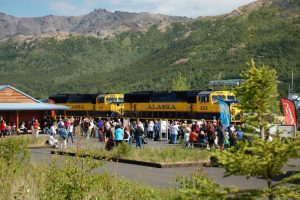
A 98.7 F 263.3 Talkeetna Y Junction: Talkeetna Spur Road leads 14 miles north to TALKEETNA (pop. 876); a popular tourist stop with shops, restaurants and lodging. Talkeetna is the jump-off point for Denali climbers (flightseeing available), for a roundtrip Alaska Railroad trip on the “Hurricane Turn” and for riverboat trips to Devil’s Canyon.

A 98.8 F 263.2 Gas station and Subway.
A 99.5 F 262.5 His & Hers phone 907-733-2415; restaurant (known for their bread pudding), gas, diesel, camping.
A 113.6 F 248.4 McKinley View Bed and Breakfast.
A 114.8 F 247.2 TRAPPER CREEK (pop. 426); post office, library.
A 114.9 F 247.1 Junction with Petersville Road to Alaska’s Northland Inn. The historic Forks Roadhouse at Mile 18.7 was destroyed by fire in April 2012. Rebuilt, the Forks Roadhouse has a full bar and restaurant (hours vary, check their Facebook page). Petersville Road accesses Peters Creek, a popular fishing spot; take left fork at Mile 18.7. Petersville Road continues west to Petersville Recreational Mining Area.
A 132.9 F 229.1 Turnoff uphill to east for Mt. McKinley Princess Wilderness Lodge; accommodations, dining, view of Denali from deck.
A 133 F 229 D&S Trailrides; 1-1/2 to 8-hour adventurous trail rides.
A 134.5 F 227.5 Mary’s McKinley View Lodge offers rooms and dining with a spectacular view of Denali.
A 134.8 F 227.2 Denali Viewpoint South Campground (Denali State Park).
A 135.6 F 226.4 Turn off to east on access road for South Denali Visitor Center Complex (1.3 miles) and Kesugi Ken Campground (1.5 miles) in Denali State Park.
A 137.2 F 224.8 Lower Troublesome Creek Campground. (Denali State Park).
A 147 F 215 Byers Lake Campground (Denali State Park).
A 147.1 F 214.9 South end of Medal of Honor Loop to Alaska Veterans Memorial/POW–MIA rest area; picnic area, toilets, viewing scopes, visitor information center. The Veterans Memorial (pictured below) consists of a semicircle of 5 concrete panels representing branches of the armed services.

A 162.6 F 199.4 Denali View North Campground (Denali State Park).
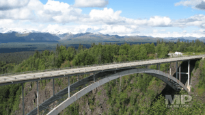
A 174 F 188 Hurricane Gulch Bridge.
A 185.6 F 176.4 East Fork Chulitna Wayside; camping.
A 201.3 F 160.7 Broad Pass summit (elev. 2,400 feet).
A 210 F 152 Junction with Denali Highway at CANTWELL (pop. 183); post office. Lodging at BluesBerry Inn; camping at Cantwell RV Park; Vitus Energy gas/diesel and convenience store. Towing and roadside assistance from Parks Highway Towing phone (907) 832-5583.
A 210.4 F 151.6 Vitus Energy; 24-hour gas/diesel, ATM, convenience store, phone 907-768-1168.
A 210.8 F151.2 BluesBerry Inn, a log cabin motel serving blueberry buckwheat pancakes; open-mic and gospel blues on some Fridays and Saturdays.
A 224 F 138 Carlo Creek bridge. Food, lodging.
A 229 F 133 Denali Cabins, Prey Bar & Eatery, Denali Backcountry Adventures.
A 229.1 F 132.9 Denali Air, Inc.; flightseeing service.
A 229.4 F 132.6 229 Parks Restaurant and tavern to west.
A 231 F 131 Lodging, dining, camping at Denali Grizzly Bear.

A 237.4 F 124.6 Junction with Park Road, entrance to Denali National Park and Preserve; Park Road leads 0.4 mile west to Riley Creek Mercantile and Riley Creek Campground; 0.7 mile to Wilderness Access Center; 1.4 miles to Denali Visitor Center Complex and Alaska Railroad Depot.
A 238 F 124 Mile 238 Rest Area; parking, toilets, access to pedestrian path. Rest area is a great place to watch rafting companies lowering rafts to the Nenana River. DENALI PARK (pop. 145 in summer) refers to the area along the Parks Highway from Carlo Creek, 13 miles south of the Park entrance, to the Nenana River Canyon, 3 miles north of the Park entrance. A variety of seasonal services are offered here, including restaurants, grocery, gas, liquor store, accommodations and souvenir shops. Raft Denali and Cabins at Denali are located across the highway from the rest area.
A 238.1 F 123.9 Turnoff to east on Grande Drive for Grande Denali Lodge.
A 238.4 F 123.6 Turnoff to east on Bluffs Road for Denali Bluffs Hotel.
A 238.5 F 123.5 Huge complex to west is Denali Princess Wilderness Lodge.
A 238.6 F 123.4 Traffic light at Denali Drive. Park Mart gas and convenience store to east. South entrance to Denali Rainbow Village RV Park & Motel. Log cabin mall on east side of highway houses local, seasonal businesses like Denali ATV Adventures and Denali Park Zipline.
A 238.9 F 123.1 Traffic light at Canyon Drive. Several local businesses to east include Denali’s Cannabis Cache; to west is the McKinley Chalet Resort.
A 239 F 123 Entering Nenana River Canyon northbound.
A 247 F 115 Junction with Otto Lake Road west; Black Diamond Resort (golf, dining, backcountry adventures) at Mile 0.8.
A 248.4 F 113.6 Brewery/restaurant.
A 248.5 F 113.5 RV park, gas and grocery.
A 248.7 F 113.3 HEALY (pop. 1,027); all services. Healy has the state’s only commercial coal mine.
A 249.2 F 112.6 Gas, diesel, propane.
A 249.5 F 112.5 Aurora Denali Lodge.
A 251.1 F 110.9 Junction with Stampede Road.
A 276 F 86 Tatlanika Trading Co. & River RV Park phone 907-582-2341; camping, wildlife mounts, arts and crafts.
A 280 C 70 F 82 Clear Sky Lodge phone 907-582-2251; steakhouse with cocktail lounge and liquor store.
A 283.5 F 78.5 Junction with paved access road to Clear Air Force Station and community of ANDERSON (pop. 536). Access to Riverside Park (City of Anderson campground), 6.3 miles west; 616 acres, trails, music festival in late July.
A 304.4 F 57.6 Nenana A-Frame Service with gas, diesel, deli/cafe, groceries, ice, ATM; phone 907-832-5823.

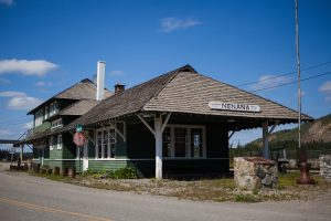
A 304.5 F 57.5 NENANA (pop. 553); Visitor information at log cabin (pictured above) at turnoff to Nenana’s main street; picnic tables, restrooms. Nenana has all services including the Rough Woods Inn & Cafe phone 907-832-5299 or email. Home of the Nenana Ice Classic.
A 313.6 F 44.4 Parks Highway Towing phone (907) 832-5583.
A 351.2 F 10.8 Turnoff for ESTER (pop. 2,041); Judie Gumm Designs (jewelry) is located in Ester (follow signs for the studio; RVs may park at Golden Eagle Saloon).
A 353.5 F 8.5 Gas station and Gold Hill Imported Beer & Wine.
A 356.8 F 5.2 Exit to Geist Road/Chena Pump Road; access to University of Alaska Museum of the North in FAIRBANKS (pop. 31,957); all services.
A 357.8 F 4.2 West Airport Way exit to Fairbanks International Airport and to Riverboat Discovery.
A 358 F 4 East Airport Way exit to River’s Edge RV Park/River’s Edge Resort and University Avenue businesses. Access to Chena River State Recreation Site.
A 360.3 F 1.7 North Peger Road to Pioneer Park; Alaska’s only Pioneer Theme park with RV parking, museums, salmon bake, shops, etc.
A 362 F 0 Junction with Richardson Highway (Alaska Route 2 South) and Steese Highway (Alaska Route 2 North) at east entrance to Fairbanks.