Dempster Highway Connects: Klondike Highway to Inuvik, NWT
Route#: Yukon Highway 5, NWT Highway 8
Length: 456 miles
Road Surface: Gravel
Season: Open all year
Highest Pass: North Fork Pass Summit, elev. 4,229 feet/1,289m
Map (1 detailed pdf file available):
Klondike Highway Junction to Inuvik, Northwest Territories
The Dempster Highway (Yukon Highway 5, NWT Highway 8) begins about 25 miles/40 km east of Dawson City, YT, at its junction with the Klondike Highway and leads 456 miles/734 km northeast to Inuvik, NWT.
The Dempster Highway can be driven in 10 to 14 hours, but it is strongly recommended that motorists slow down and enjoy the trip, allowing extra time for hiking, camping, fishing, wildlife viewing (especially birds) and the spectacular photo opportunities this remote road affords.

Continue on beyond Inuvik to Tuktoyaktuk, on the shore of the Arctic Ocean, via the Inuvik–Tuktoyaktuk Highway. This 140-km/87-mile-long road passes by Pingo National Landmark and offers unique scenery.
Motorists looking for a shorter side trip from the Klondike Highway might just make the 44-mile/71-km drive up to the Tombstone Interpretive Centre, a popular day trip alternative. Extend your stay with an overnight at the Tombstone Mountain Campground, then retrace your route the next day. Or drive 229 miles/369 km to the approximate half-way point on the Dempster Highway at Eagle Plains Hotel, overnight and return.
Construction of the Dempster Highway began in 1959, and was completed in 1978, although it did not officially open until Discovery Day weekend in 1979. It was built to provide access to the Canadian Arctic and to accommodate oil and gas exploration activity. It was named for Inspector William John Duncan Dempster of the RCMP.
The first 5 miles/8 km of the Dempster are seal-coated, and the last 6 miles/10 km are paved, but the rest of the road is gravel. Although in relatively good condition, this highway requires drivers pay attention at all times for sudden changes in road surface, including frost heaves, potholes, boggy or slick stretches, crushed shale (hard on tires), and other drivers. Drivers should pull over (if space allows) for oncoming trucks or to allow trucks to pass. Drive with your headlights on at all times.
The speed limit is 90-kmph/55-mph unless otherwise posted. Calcium chloride is used to reduce dust and as a bonding agent; wash your vehicle as soon as practical. Some stretches of this highway can be very slippery in wet weather!
It is strongly advised that Dempster motorists carry all necessary tire change-over equipment and 2 full-sized spare tires (on rims, fully inflated), extra water and gas.
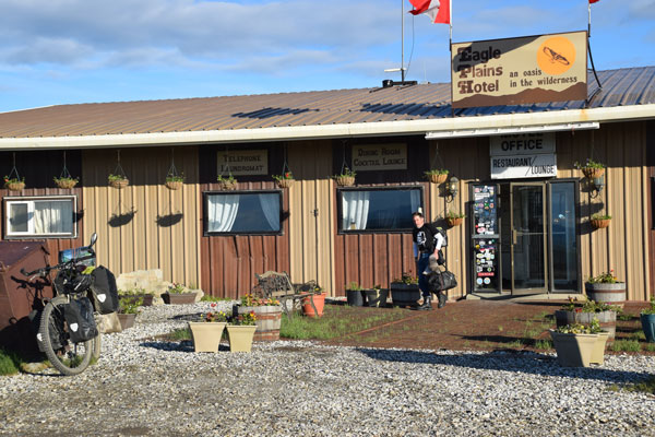
Facilities are still few and far between on the Dempster. Full visitor services are available in Dawson City, 25 miles/40 km north of the Dempster Highway turnoff (at Dempster Corner) on the Klondike Highway. Dempster Corner, at the junction, has a public cardlock gas/diesel station. Gas, diesel, propane, food, lodging, and car and tire repair are also available at Eagle Plains Hotel (phone 867-993-2453), located 229 miles/369 km from the Klondike Highway junction and about halfway on the Dempster. Gas, food and lodging are also available in Fort McPherson (113 miles/182 km beyond Eagle Plains Hotel). Inuvik has all visitor services. Gas up whenever possible. Also fill water containers whenever possible.
Summer gives visitors long hours of daylight for recreation and the highway is well-traveled: A driver may not see another car for an hour, and then pass 4 cars in a row. Locals say the highway is smoother and easier to drive in winter, but precautions should be taken against cold weather, high winds and poor visibility; check road conditions before proceeding in winter. Watch for herds of caribou mid-September to late October and in March and April.
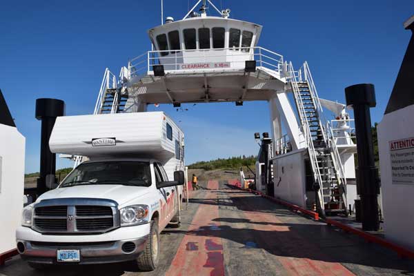
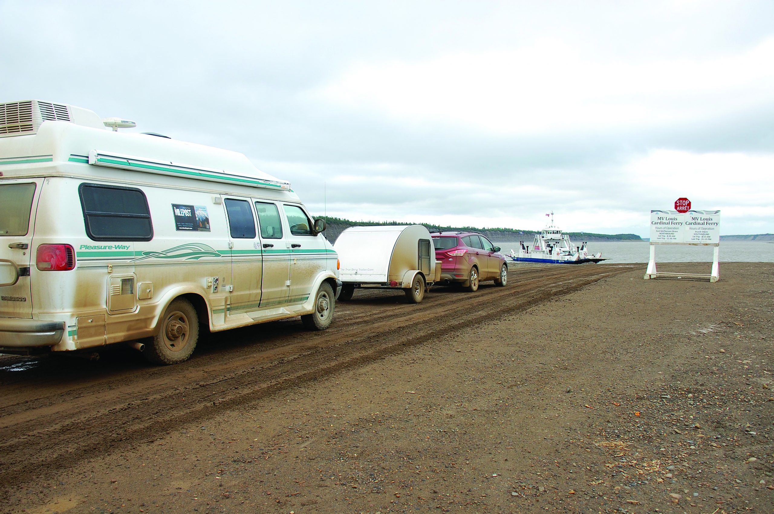
Free government ferry service is available approximately 15 hours a day in summer at each of the 2 river crossings on the Dempster: At the Peel River, Milepost J 334.9, on the Abraham Francis; and at the Mackenzie River, Milepost J 377.4, on the Louis Cardinal. Ferries operate regular schedule from late May or early June to mid-October or early November. Crossing is on demand and/or by ice bridge in winter. “Ferries in the NWT can close with little or no notice due to low water levels, ice conditions, or other factors. Caution should be used on landings and approaches. Always check road bulletins before traveling to ensure ferries on your route are operating normal hours.” For details on ferries visit www.inf.gov.nt.ca/en/ferries and www.dot.gov.nt.ca/Highways/Highway-Conditions for road conditions. For recorded messages on current highway conditions, phone 1-800-661-0750.
Remember to pack the bug spray: mosquitoes and black flies can be fierce during the summer. Also remember to pack bear spray.
Conservation officers have warned that anybody traveling on the Dempster Highway should take precautions to avoid a bear encounter, and cyclists should be sure to have bear spray handy at all times.
Communities
The MILEPOST® Quick Reference Log
Miles from Klondike Highway 2 junction (J) shown.
J 0 Dempster Corner, 25 miles/40 km southeast of Dawson City. AFD public cardlock gas station with diesel at northeast corner. NOTE: Next gas northbound is at Eagle Plains, 229 miles/369 km from here.

J 44 Tombstone Interpretive Centre; large parking area, outhouses, litter bins. Open daily from early May to late September. The center provides interpretive programs, issues backcountry camping permits, provides maps and hiking information.
J 44.5 Tombstone Mountain Yukon Government Campground.
J 46 Tombstone Range Viewpoint.
J 49.3 North Fork Pass Summit, elev. 4,593 feet/1,400m, is the highest point on the Dempster Highway and the continental divide between the Yukon River watershed, where rivers flow west to the Bering Sea, and the Mackenzie River system, where rivers flow north into the Beaufort Sea.
J 63.7 Turnout with information panels, viewing platform for Two Moose Lake and litter bins.
J 95.2 Windy Pass Summit (elev. 3,478 feet/1,060m).
J 120.4 Engineer Creek Yukon Government Campground.
J 160.9 Ogilvie Ridge/Gwazhal Kak Viewpoint is a large double-ended turn- out with interpretive panels on the geology of the area.
J 229.3 EAGLE PLAINS (pop. approx. 8); Eagle Plains Hotel, open year-round. 32 hotel rooms, satellite TV, plus restaurant and lounge. Wi-Fi available in lobby. Full camping facilities with electrical hookups. Showers, store, minor repairs, tires, gas/diesel/propane.
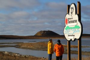
J 252 Arctic Circle Crossing, N 66°33’; interpretive sign, picnic tables, litter bins, outhouses.
J 277 Rock River Yukon Government Campground.
J 288.9 YT-NWT Border. Highway crosses Wright Pass (elev. 3,000 feet/915m) and the Continental Divide in the Richardson Mountains.
J 334.9 Peel River Crossing, locally called Eight Mile because it is situated 8 miles/12.8 km south of Fort McPherson. This free government ferry—the CF Abraham Francis—is a double-ended cable ferry: Drive on, drive off.
J 336 Nataiinlaii Territo- rial Park Interpretive Centre and Campground.
J 341.9 Junction with access road which leads west to FORT McPHERSON (Tetl’it Zheh); pop. 900; grocery stores, food, gas/diesel, lodging. Photos and artifacts depicting the history and way of life of the community are displayed in the Chief Julius School. The Lost Patrol Gravesite is in the cemetery outside the Anglican church.
J 377.4 South bank line-up for Mackenzie River Crossing, free government ferry MV Louis Cardinal.
J 426 Vadzaih Van Tshik Campground.
J 433.2 Tithegeh Chii Vitaii Lookout to west; parking. Very scenic 10-minute walk to viewing platform with information signs overlooking Campbell Lake.
J 434.5 Gwich’in Territorial Park Campground.
J 440.5 Ehjuu Njik (part of Gwich’in Territorial Park) day-use area downhill to west; picnic tables, firepits, outhouses.
J 442.4 Nihtak (part of Gwich’in Territorial Park) day-use area.
J 453.8 Jàk Territorial Park and Campground.
J 455.3 Arctic Chalet and Arctic Adventure Tours, phone 1-800-685- 9417. Lodging and guided Dempster Highway, Tuktoyaktuk and Herschel Island tours.
J 456.1 Junction: Turnoff for Inuvik town center via Mackenzie Road; Nova Inn. Northbound sign indicates left turn for Inuvik, straight ahead for Tuktoyaktuk and Truck Route. Continue straight ahead for Tuktoyaktuk by following Marine Truck Bypass—which skirts Inuvik—4 miles/6 km to Navy Road, then turn right for Inuvik–Tuktoyaktuk Highway (ITH), the all-season road to Tuktoyatuk on the Arctic Ocean.
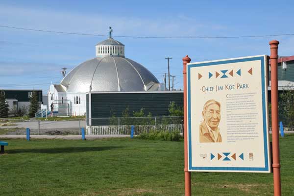
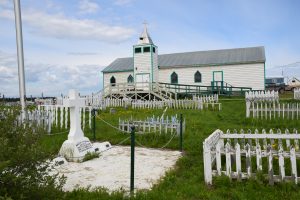
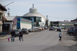
INUVIK (pop. 3,243) has all services. Situated on the east channel of the Mackenzie River, some 60 air miles/ 96 km south of the Beaufort Sea, at the end of the Dempster Highway.