")
The scenic Chilcotin Highway (BC Highway 20) leads 279 miles/450 km west from Williams Lake to Bella Coola. Called “Freedom Road” by residents, the highway was bulldozed across the mountains in the 1950s by local volunteers tired of waiting for the government to build a road.
Once a test of endurance, much of today’s road is paved and in good condition. There is still “The Hill,” a narrow, 11.2-mile/18-km, gravel switchback descent from the top of Heckman Pass (elev. 5,000 feet/ 1,524m) into the Bella Coola Valley with 12 to 18 percent grades. Vehicles towing fifth wheelers or travel trailers test your brakes before attempting The Hill.
Return to Milepost CC 126.2
West Access Route
Communities
NOTE: This highway log last appeared in the 2014 edition of The MILEPOST, when changes in direct ferry service between Bella Coola and Prince Rupert/Port Hardy necessitated the exclusion of this route. It is reprinted here in its original form. Be aware that changes may have occurred along the road since this route was last logged by our field editors. Also check with BC Ferries for current information on direct ferry service between Bella Coola and Port Hardy.
Distance from junction (J) with Highway 97 at Williams Lake is shown.
J 0 Junction with Highway 97 at Williams Lake. Access to Stampede Grounds (watch for turn); camping.
J 1.5 (2.5 km) Road south to Alkali Lake and Dog Creek. Road closure sign warns if Heckman Pass is closed. Westbound, Highway 20 climbs to plateau, then drops down a 5 percent grade to the Fraser River.
J 15 (24 km) Viewpoint at east end of Sheep Creek bridge over Fraser River. Begin 6 percent grade westbound.
J 17.4 (28 km) Small turnout with map of Chilcotin wildlife viewing areas and information on the Chilcotin grasslands.
J 20.3 (32.7 km) Turnout with toilets and litter barrels. Begin steep downgrade eastbound; watch for logging trucks.
To the west is the great Fraser Plateau, with the snowcapped peaks of the Coast Range visible on the horizon. The country west of the Fraser is known as the Chilcotin, taking its name from the river that cuts through the plateau. The country is chiefly range land for cattle, though forestry is also important.
J 27.5 (44.4 km) Gravel road loops south and rejoins Highway 20 at Lee’s Corner (50-mile/80-km drive). Follow this winding side road south 10 miles/16 km to Farwell Canyon bridge on the Chilcotin River.
J 28.7 (46.3 km) Riske Creek.
J 29.4 (47.3 km) Stack Valley Road to Historic Chilcotin Lodge, now a bed and breakfast. Camping.
J 30.4 (48.9 km) Forest Service recreation area; at Becher Dam; fishing for small rainbow, picnic tables.
J 35.6 (57.4 km) Riske Creek rodeo grounds. Stampede held in mid-June.
J 42.2 (68 km) Gravel road north to Forest Service recreation area on Raven and Palmer lakes; fishing; boat launch.
J 50.9 (81.9 km) Hanceville Recreation Area to south; rest area with toilet, litter barrel and historic marker about Norman Lee and ill-fated Yukon cattle drive of 1898. Begin 9 percent downgrade westbound.
J 56 (90.1 km) Lee’s Corner, on site of Norman Lee’s ranch house. Hanceville post office, gas, diesel, propane, groceries and food in old-fashioned general store.
Turnoff south for old settlement of Hanceville, named for Tom Hance, the original settler and author of Klondike Cattle Drive. Gravel road continues south across Chilcotin River (a favorite with river rafters) to Fletcher Lake Forest Service Recreation Area; canoeing and fishing. Road loops back to the highway at Milepost J 27.5.
J 62.5 (100.6 km) Store, gas and diesel at Anaham Village (TL’etinqox), the largest of 6 Indian reserves in the Chilcotin. Speed limit 45 mph/70 kmph through reserve.
J 69.5 (112 km) Turnout to north with information sign.
J 69.8 (112.3 km) ALEXIS CREEK (pop. 140); vehicle repair, groceries, ATM, post office, cafe, RV sites, hotel, stores, RCMP outpost, medical centre.
J 72.8 (117.3 km) Steep downgrade westbound. View of Chilcotin River and volcanic cliffs of Battle Mountain.
J 74.8 (120.5 km) Bull Canyon Provincial Recreation Area; picnic tables, outhouses, 20 campsites in aspen forest beside Chilcotin River. Beautiful spot. Kayaking, rafting and fishing are popular. Camping fee charged.
J 90.2 (145.2 km) Chilcotin River bridge; Westbound, the Chilanko River is to the south of the highway.
J 103.3 (166.3 km) Native community of Redstone; general store, gas and diesel.
J 105 (169 km) Stunning views westbound of snowcapped Coast Mountains.
J 107.6 (173.3 km) Chilanko Forks. Road north to Puntzi Lake (4.5 miles/7 km); resorts, campgrounds, fishing. Birds at Puntzi Lake include pelicans and loons.
J 109 (175.5 km) Puntzi airport road leads to Chilanko Marsh Wildlife Area.
J 113.4 (182.5 km) Gravel road south to Pyper Lake Recreation Area; picnic tables and fishing.
J 115.7 (186.3 km) Gravel turnout with view of the long, deep valley of Tatla Lake.
J 129.2 (208 km) Viewpoint.
J 130.5 (210 km) Rest area with picnic tables and outhouse at Pollywog Marsh, a wetlands conservation area (Ducks Unlimited).
J 131.6 (211.9 km) Road north to Tatla Lake Recreation Area; fishing and boat launch.
J 131.8 (212.2 km) Side road south to Eagle Lake.
J 133.1 (214.3 km) Road south to Pinto Lake Recreation Area; picnic tables, boating.
J 137 (220.6 km) Side road south to Tatlayoko Lake (21.5 miles/35 km), jumping-off point for expeditions to Mount Waddington (elev. 13,100 feet/3,994m), highest peak in the province, also known as Mystery Mountain.
J 137.9 (222 km) Tatla Lake; food, gas, lodging, store, post office and clinic. Historic Graham Inn.
J 146.1 (235.2 km) Bridge across Klinaklini River.
J 152.5 (245.5 km) Road north to One Eye Lake Recreation Area; fishing and boating.
J 155.7 (250.7 km) Small community of Kleena Kleene; phone.
J 156 (251.1 km) Kleena Kleene bridge. Turnout at west end.
J 159 (256 km) Clearwater Lake Resort and provincial recreation site.
J 162.5 (261.5 km) Bridge over McClinchy Creek, a tributary of the Dean River. CAUTION: Cattle at large.
J 177.7 (286.1 km) Road south to Charlotte Lake (12 miles/20 km); rainbow fishing and lodging.
J 180.8 (291.1 km) Turnout to north with information sign about Nimpo Lake.
J 184.3 (296.6 km) NIMPO LAKE; called the “Freshwater floatplane capital of B.C.”. Visitor services include a general store, gas, propane, phone, RV park, restaurant and fishing resorts. The 7.5-mile/12-km-long lake contains rainbows.
J 187.4 (301.6 km) Dean River bridge. Forest Service recreation site turnout; canoeing and fishing.
J 190.2 (306.1 km) Anahim Lake Resort.
J 195.2 (314.2 km) ANAHIM LAKE, (pop. 1,500) largest community in the Chilcotin; daily 1-hour flights to/from Vancouver. Anahim Lake is a centre for guided wilderness hiking and fishing trips. Groceries at Christensen’s general store. Food, gas and lodging available. Annual stampede held in mid-July. Early ranching in this area is described in the classic, Grass Beyond the Mountains, by Richmond Hobson.
The Anahim area is a major stop on the Pacific Interior Flyway. Good bird watching on Eagle’s Nest Marsh Trail, southwest side of Anahim Lake, for American white pelicans, eagles and osprey, great horned and great grey owls, goshawks, trumpeter swans and sandhill cranes.
J 196 (315.5 km) Pavement ends, hard-packed dirt and gravel begins, westbound.
J 201.6 (324.5 km) Eagles Nest Resort.
J 212.5 (342.1 km) Louie Creek; turnout at west end.
J 215.1 (346.2 km) Turnout with information sign on the West Chilcotin.
J 217.1 (349.5 km) East entrance to Tweedsmuir Provincial Park, the largest park in British Columbia. Highway 20 borders the park for the next 34 miles/54 km westbound. Best known features in Tweedsmuir are Hunlen Falls (Canada’s second highest waterfall) and the Monarch Ice Fields (accessible by flightseeing).
View to north of Rainbow Mountains.
J 221 (355.7 km) Trailhead and picnic site with outhouse and information sign.
J 221.5 (356.4 km) Summit of Heckman Pass (elev. 5,000 feet/1,524m). The pass is kept open year-round.
J 221.9 (357.1 km) Brake check area and road closure gate. CAUTION: Highway begins steep 2-part descent westbound; 18 percent grade, narrow road, rock slides, hairpin bends. Use low gear. Use turnouts.
J 225.2 (362.4 km) Bridge over Young Creek; turnout at east end.
J 232.7 (374.5 km) Begin steep climb.
J 233.3 (375.5 km) Hunlen Falls/Turner Lakes trailhead.
J 233.6 (376 km) Turnout with litter barrels and information signs.
J 234.1 (376.8 km) Atnarko River Campground; 28 campsites, sani-station, camping fee, fishing. Old growth Douglas fir.
J 234.5 (377.4 km) Tweedsmuir Provincial Park headquarters. Dump station.
J 236.5 (380.6 km) Tweedsmuir Trailhead on Mosher Creek.
J 241.1 (388.1 km) Big Rock Picnic Area and Kettle Pond trailhead (1-hour loop).
J 243.3 (391.6 km) Tweedsmuir Lodge.
J 243.8 (392.4 km) Fisheries Pool Campground; 14 campsites, fee, boat launch and picnic area beside Atnarko River. Salmon spawning channels and viewing pool.
J 246.8 (397.2 km) Boat launch.
J 247 (397.6 km) Horsetail Falls Creek.
J 249.7 (402 km) Heritage Mackenzie/Grease trailhead and picnic area; water, litter barrels. Valley View loop trail (1 to 1-1/2 hours) along a portion of the Grease Trail leads to a good viewpoint of the river and Stupendous Mountain (elev. 8,800 feet/2,700m).
J 249.9 (402.2 km) Burnt Bridge. West boundary of Tweedsmuir Provincial Park.
J 254.4 (409.4 km) Settlement of Firvale.
J 259.1 (417 km) Bella Coola bridge.
J 268.4 (432 km) HAGENSBORG (pop. 279), food, gas, RV parks, groceries and lodging. Settled in 1894 by Norwegians from Minnesota, who found the country similar to the fjords of their homeland. Notable here are the Augsburg Church (built in 1904 and still in use) and the Hagensborg Norwegian Heritage House, built by Andrew Svisdahl in the early 1900s. Furnished as a typical Norwegian home of that time period, it is well worth a visit.
J 269.6 (434 km) Private RV Park & Campground.
J 271.2 (436.5 km) Turnoff to Bella Coola airport.
J 272.4 (438 km) Snootli Creek Fish Hatchery.
J 274.2 (441.3 km) Eagle Lodge and Campground.
J 276.2 (444.5 km) Road south up Thorsen Creek leads to one of the most extensive collections of ancient rock carvings in the world. This site has more than 100 glyphs. Inquire locally for directions.
J 277 (446 km) Acwsalcta, School of the Nuxalk Nation, constructed of cedar with Indian graphic designs and carvings; well worth a stop.
Bella Coola
J 279.3 (449.5 km) Entering Bella Coola via Highway 20. Paved road continues around the tidewater flats at the head of the inlet for 1.2 miles/2 km to the fishing harbor and B.C. Ferries dock. Population: 2,200 (Bella Coola Valley).
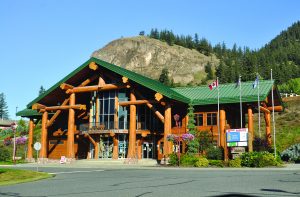
Visitor Information: Visitor information centre is in the Co-op store on Mackenzie Street. Local businesses, such as the Kopas Store, are helpful. Visit www.bellacoola.ca
Transportation: Air—One-hour flights to Vancouver, daily year-round, twice daily in summer; local charter service; helicopter base. Ferry—B.C. Ferries vessels link Bella Coola and other coastal communities with Port Hardy on the north tip of Vancouver Island. Go to www.bcferries.com for current schedule.
Bella Coola has all visitor services, including lodging, camping and dining at local inns and motels/hotels. Bed-and-breakfast accommodations also available.
Alexander Mackenzie was the second white man to visit this settlement at the head of North Bentinck Arm in 1793 (Captain George Vancouver and crew beat him by 2 weeks). The Hudson’s Bay Co. established a trading post here in 1869.
Attractions in the Bella Coola Valley include the spectacular scenery (Hunlen Falls is Canada’s third highest single-drop waterfall in Canada); the Kopas Store, established in 1937 (Cliff Kopas is author of Bella Coola History); totem pole at the old band office in town and murals at the First Nations’ Acwsalcta School; and the Bella Coola Museum, which displays Hudson’s Bay Co. relics and items brought by Norwegian settlers, and has a good photo display of the building of “The Freedom Road.” Town is home to Bella Coola Band/Nuxalk Nation.
The area offers hiking, mountain biking, rock climbing and heli-skiing. Boat trips to Alexander Mackenzie Historic Park in Dean Channel, where the explorer left a record of his momentous journey: “From Canada by Land, 22nd July, 1793,” inscribed on a rock.
Special events include the annual Bella Coola rodeo, one of the largest amateur rodeos in Western Canada, held the July 1st weekend; the Discovery Coast Music Festival, which takes place in mid-July; and the annual Bella Coola Fall Fair Day and Logger’s Sports event, held Labour Day weekend.

