Connects: Alaska Hwy./Tetlin Junction to Eagle, AK
Routes#: Alaska 5
Length: 160 miles
Road Surface: 45% paved, 55% gravel
Season: Closed in winter
Map (1 detailed pdf file available):
Tetlin Junction, Alaska Highway to Eagle, AK
Before traveling the Taylor Highway please visit 511 Alaska or call 511 for the latest road conditions.
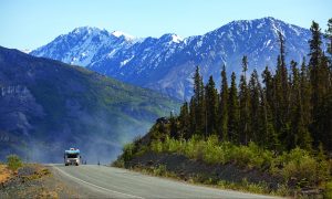
The Taylor Highway begins at Tetlin Junction on the Alaska Highway, 12 miles southeast of Tok, and ends at historic Eagle on the Yukon River. This is a beautiful “top of the world” drive.
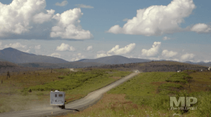
The first 64 miles of the Taylor Highway are paved, with some sections damaged by mild to severe frost heaving. Road surface ranges from good to poor on the gravel portion, depending on maintenance. Rough spots are not always flagged. Shoulders are generally narrow and may be soft and unstable.
The Taylor Highway forks at Jack Wade Junction, Milepost TJ 95.5: the Boundary Spur Road goes east to the Top of the World Highway to Dawson City, YT; the Taylor Highway continues north to Eagle. Between Chicken and Eagle, the Taylor Highway is narrow, winding, gravel road with many steep hills and some hairpin curves. The road from Jack Wade Junction to Eagle is not recommended for RVers.
The MILEPOST® Quick Reference Log
Miles from Tetlin Junction (TJ) shown.
TJ 0 Junction with the Alaska Highway, Milepost 1301.7 (Milepost DC 1266.7), Tetlin Junction. Fortymile Roadhouse historic landmark.
TJ 35 Mount Fairplay Wayside; interpretive signs, outhouse.
TJ 43 Logging Cabin Creek BLM picnic and rest area.
TJ 49 West Fork BLM Campground.
 TJ 66.4 CHICKEN (pop. 23). Access via Airport Road to Downtown Chicken which includes the Chicken Creek Café and Saloon (pictured here), gas, free RV parking (self-contained), and gold panning; and to Chicken Gold Camp & Outpost, site of the Pedro Dredge, a cafe, gift shop, cabins, camping, gold panning and recreational mining. Actual driving distance between physical Mileposts 66 and 67 is 0.6 mile.
TJ 66.9 Town of Chicken also known as the Gold Panner with food, gas, diesel, camping, lodging. Daily tours of Tisha’s School House.
TJ 68.1 Mosquito Fork Dredge Hiking Trailhead to east, parking to west; 20- to 40-minute downhill walk to overlook.
TJ 75.2 South Fork River Wayside.
TJ 82 Walker Fork BLM Campground.
TJ 95.5 Jack Wade Junction. Junction with Boundary Spur Road/Top of the World Highway which leads east 79 miles to DAWSON CITY, YT. Northbound: Keep to left for Taylor Highway to Eagle, Alaska; keep to right for Boundary Spur Road, Canadian border and Dawson City, YT. Southbound, if going to Chicken, keep to the left.
TJ 112.5 Fortymile River bridge; BLM wayside at south end with picnic tables.
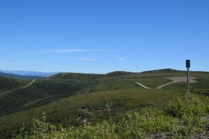
TJ 143.2 American Summit. Top of world views; fireweed display in summer.
TJ 159.3 Telegraph Hill Services; gas/diesel, tire repair.
TJ 160.3 Turnoff for Eagle BLM Campground and Fort Egbert.
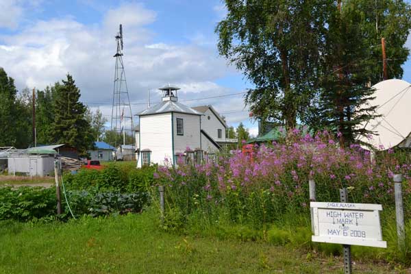
TJ 160.6 Taylor Highway ends at Front Street in EAGLE (pop. 86). Visitor information. Lodging at Falcon Inn Bed & Breakfast. Camping at Eagle BLM campground. Attractions: Eagle Historical Society Museum in the Wickersham Courthouse (1901), pictured below; Fort Egbert (1899); and the Yukon River.